


Australia just committed $207 million to a major satellite program. What is it, and why do we need it?
- Written by: Cassandra Steer, Deputy Director, Institute for Space (InSpace), Australian National University
Last week, the federal minister for Resources and Northern Australia, Madeleine King, signed a A$207 million commitment with the United States[1] in support of “Landsat Next”.
Aptly named, this is the next generation of an Earth observation satellite program from which Australia has benefited for over 40 years[2].
The commitment means we will make a critical contribution to global Earth observation efforts with our cutting-edge data management. In essence, we will be the custodians of data downloaded from new Landsat satellites – a major role.
Read more: Landsat turns 50: How satellites revolutionized the way we see – and protect – the natural world[3]
What is Earth observation?
Earth observation satellites provide the world with more than half of all climate change data – and some of that data can come from nowhere else but space. They also provide over 90% of weather data, which the Bureau of Meteorology uses to give us our daily forecasts.
In Australia, Earth observation data is also critical for supporting[4] agriculture, fisheries, mining, land and water policies[5], bushfire response, and national security needs. In 2020, the economic benefits of Earth observation data were estimated at over A$2.4 billion[6].
Furthermore, such data brings immense benefits to First Nations people, particularly in northern Australia. Indigenous rangers use Earth observation data to augment their traditional land and water management practices.
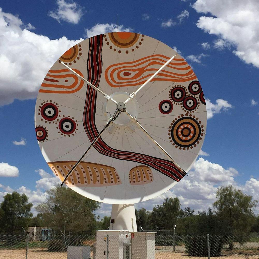
Importantly, Geoscience Australia and CSIRO work closely with the Centre for Appropriate Technology[8], an Indigenous business in Alice Springs. This business owns a satellite dish that receives data from Landsat and other Earth observation satellites.
Read more: ‘Painting with fire’: how northern Australia developed one of the world’s best bushfire management programs[9]
What is Landsat?
Landsat is a program led by NASA and the US Geological Survey. For more than 50 years[10] it has provided the “longest continuous space-based record of Earth’s land in existence”.
This means since 1972 we’ve had continuous data on ice melts, weather and temperature changes, and changes in the planet’s landscapes and freshwater sources.
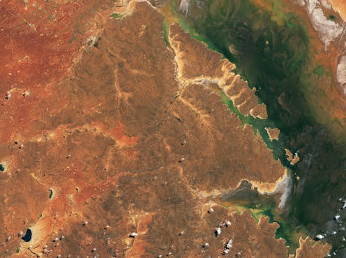
Australia has been a Landsat beneficiary and partner since the early 1970s. Just earlier this year, emergency services in Queensland facing Cyclone Kirilly depended on Landsat data to help mitigate potential flooding[11]. Geoscience Australia has also used Landsat data gathered over decades to map changes in Australia’s shorelines[12].
And during the Black Summer megafires of 2019–20, the worst bushfire season New South Wales has ever recorded, Landsat images were critical[13] in predicting where the bushfires would be worst, and assisting in real-time response.
The new agreement places us at the centre of data management for the next generation of Landsat.
Read more: I made bushfire maps from satellite data, and found a glaring gap in Australia's preparedness[14]
What is Landsat Next?
There have been nine Landsat satellites since 1972, of which eight are operational today. Landsat Next will add three more satellites to this, with new capabilities. As a result, we will get more data more often, and at a higher resolution.
Landsat Next will significantly improve image resolution of some of the original satellites. This means, for example, that 40% more detail can be captured for agricultural sowing, irrigation and harvesting needs.
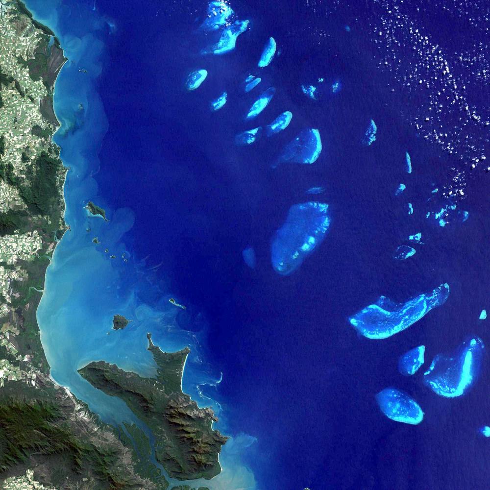 The Great Barrier Reef imaged by Landsat in 1999.
NASA Earth Observatory[15]
The Great Barrier Reef imaged by Landsat in 1999.
NASA Earth Observatory[15]
The current Landsat satellites cover 11 spectral bands. These are wavelengths of light captured by satellite sensors, ranging from visible light which we can see with the naked eye to invisible wavelengths like infrared and ultraviolet.
Landsat Next will increase this to up to 26 bands, which makes it possible to track water quality at much greater accuracy. This is helpful, for example, in detecting harmful algal blooms.
Landsat satellites also sense thermal bands. This is a measurement of surface temperatures so we can understand soil health and water levels, and track bushfires.
Landsat Next will improve the resolution of temperature measurements, providing improved climate change data and more accurate information for farmers and sustainable urban planning.
Read more: Landsat zooms in on cities' hottest neighborhoods to help combat the urban heat island effect[16]
Australia is great at satellite data
The new commitment builds on what Australia already does, and is really good at – the ground and data segments of Earth observation satellite systems. In fact, we are a world leader in Earth observation data management[17].
We have excellent geography[18] for collecting data from the satellites via large satellite dishes in Alice Springs. We also have a longstanding tradition of being the data custodians and stewards for our US and European partners.
The Landsat Next agreement fulfils one aspect of the planned National Space Mission for Earth Observation[19] (NSMEO) which was cancelled last year due to major budget cuts[20]. This was a disappointment to many people in Australia, and to our international partners.
This new commitment to Landsat Next puts in place part of what we were already planning to do through the NSMEO, and will make us a more important partner in global Earth observation infrastructure.
With our unique geography, Australia is a heavy user of Earth observation data, and this agreement means we can be bigger contributors, as well.
Read more: The first-ever survey on Australian attitudes towards space is out. So, what do we think?[21]
References
- ^ signed a A$207 million commitment with the United States (www.usgs.gov)
- ^ over 40 years (www.ga.gov.au)
- ^ Landsat turns 50: How satellites revolutionized the way we see – and protect – the natural world (theconversation.com)
- ^ is also critical for supporting (www.spacegovcentre.org)
- ^ water policies (www.csiro.au)
- ^ A$2.4 billion (www.deloitte.com)
- ^ USGS (www.usgs.gov)
- ^ Centre for Appropriate Technology (cfat.org.au)
- ^ ‘Painting with fire’: how northern Australia developed one of the world’s best bushfire management programs (theconversation.com)
- ^ For more than 50 years (landsat.gsfc.nasa.gov)
- ^ help mitigate potential flooding (www.canberratimes.com.au)
- ^ map changes in Australia’s shorelines (landsat.gsfc.nasa.gov)
- ^ Landsat images were critical (www.dea.ga.gov.au)
- ^ I made bushfire maps from satellite data, and found a glaring gap in Australia's preparedness (theconversation.com)
- ^ NASA Earth Observatory (earthobservatory.nasa.gov)
- ^ Landsat zooms in on cities' hottest neighborhoods to help combat the urban heat island effect (theconversation.com)
- ^ world leader in Earth observation data management (www.space.gov.au)
- ^ We have excellent geography (www.youtube.com)
- ^ National Space Mission for Earth Observation (www.csiro.au)
- ^ major budget cuts (www.abc.net.au)
- ^ The first-ever survey on Australian attitudes towards space is out. So, what do we think? (theconversation.com)