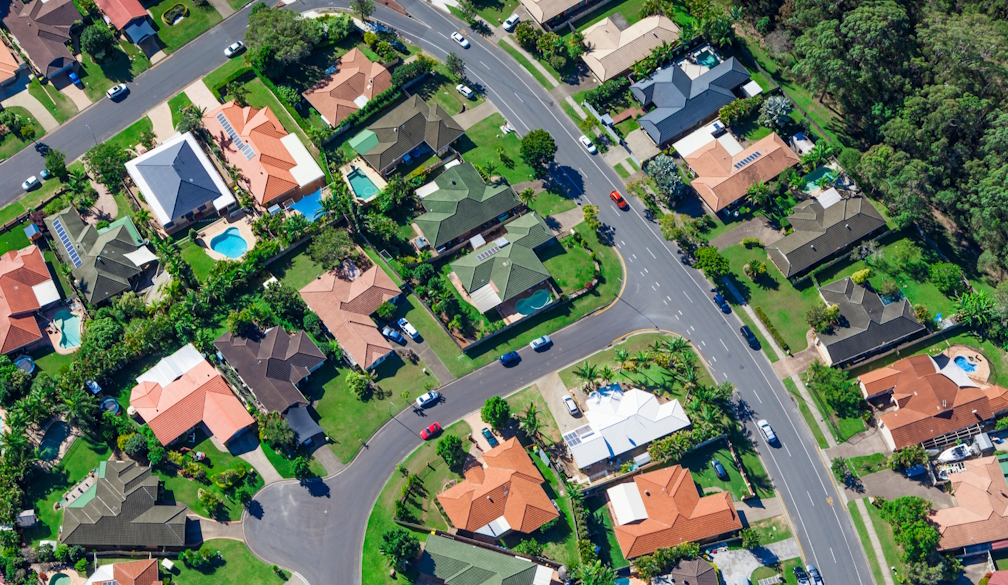
Cadastral Land Survey: Defining Property Boundaries with Precision

A cadastral land survey, or cadastral boundary survey. is vital in managing lands and property ownership. Such surveys are a specific sort of study that is vital in identifying the economic limits of property throughout its historical past for assurance and preservation in the land records system. This article discusses what cadastral land surveys are, their significance, and how they can be conducted.
All About Cadastral Land Survey
An official land survey entails accurately measuring property lines or a land parcel. The term cadastral comes from the word cadastre, which is a public record, survey, or map of land parcels and their ownership often used to assist in tax assessments. Cadastral surveys also play an important role in documenting property rights, settling boundary disputes, and supporting land administration systems.
A cadastral land survey is primarily used to define property boundaries, establish accurate measurements of the size and shape of land parcels, identify any encroachments or overlaps with adjacent properties, provide legal documentation for property transactions, and assist in land registration and taxation systems.
The Importance of Cadastral Boundary Survey
Cadastral boundary survey plays a vital role in several ways. They minimise the chances of landowner disputes and provide legal certainty by defining property lines recognised in law. Up-to-date boundary information matters in property transactions as it is needed for buying, selling, and transferring land ownership.
Cadastral surveys are crucial for developers to ensure their construction falls within the legal boundaries of the developed property. Another utility is that governments use cadastral data to evaluate the economic value of properties and calculate the tax rate accordingly. Land use is a crucial aspect of urban planning and infrastructure development facilitated by cadastral information. Thirdly, defining realistic land limits is vital for managing resources, enabling conservation activities and sustainable development of natural assets.
The Cadastral Survey Process
The cadastral survey process includes multiple vital stages. The initial stage is research and planning, where surveyors collect records of the property in question, available deeds, or any previous surveys. These professionals review legal descriptions and prior survey records and find possible boundary problems or conflicts.
The following step is field surveying, in which measurement tools such as a total station or GPS receiver are set up. Surveyors find and confirm existing corners and monuments, measure the distances and angles between points that define a boundary—commonly referred to as parcel or lot lines—and record additional data from natural and man-made features that may impact property lines.
Data analysis and calculations come after the fieldwork, where all the measurements taken in the field are processed and compared with existing records. As needed for discrepancies or conflicts in boundary information, records are resolved, and the exact coordinates of property corners and boundary lines are determined.
Boundary determination involves interpreting all relevant evidence to arrive at the highest-quality location for property lines based on principles such as senior rights and adverse possession and addressing conflicts in boundary locations.
After determining the boundaries, the surveyor creates documentation and mapping, such as a detailed survey plat or map showing property boundaries, encroachments, easements, and critical features; a written report describing the surveying methodology and findings; and legal descriptions of the property derived from survey results.
Once completed, the survey documents of the land plot are presented for verification and endorsement by local bodies or land registration authorities. Any comments or requests for more information follow the final approval and certification of the cadastral survey.
Technologies Used in Cadastral Surveying
Modern technologies increase the quality of today's cadastral land survey. Global Navigation Satellite Systems (GNSS) technology is one of the most critical, and high-precision GPS and other satellite positioning systems help surveyors determine the precise locations of property corners and lines.
The total station is another invaluable instrumental tool. It is an electronic theodolite capable of measuring angles and distances to compute the exact coordinates of survey points. This helps monitor data collection during the survey.
LiDAR (light detection and ranging) is frequently used in cadaster surveys. Aerial or terrestrial LiDAR scanning provides fast, high-density three-dimensional data of terrain and structures over large areas, giving a multiple-perspective view of the survey land.
Drones with cameras or LiDAR sensors provide high-resolution images and topographic data to UAVs (unmanned aerial vehicles) for cadastral mapping. They can sweep miles of the area quickly, making them a good value for large-scale surveys.
GIS is necessary for integrating, analysing, and visualising cadastral data and all other spatial information. GIS software assists surveyors in making precise maps by analysing how close boundaries are to other features like roads, rivers, and homes.
Finally, electronic devices were used to make field data collection more efficient and transparent by avoiding transcription errors. These devices improve data accuracy and speed up survey result processing.
Focus Areas or Challenges in Cadastral Surveying
Among the challenges cadastral land surveyors encounter is that historical records of surveys may need to be more representative, with discrepancies dating back hundreds of years, making it arduous to reconcile old survey data and maintain them as part of a modern cultural resource. Boundary markers can shift or change due to changing landscapes like erosion or human activity, which makes property boundaries more challenging to determine. Advances in technology can also lead to measurement breaks, making historical and new data difficult to compare—this requires careful reconciliation between the two.
Interpreting historical deeds and disputes results in legal complexities, creating a necessity for legal expertise. Surveyors sometimes need help with access issues, such as challenging terrain or restrictions from property owners, when finding a way in. Furthermore, coordinate system conversion from one area to another requires the data to be perfectly aligned to achieve precision.
The Role of Cadastral Surveyors
One of the significant roles of cadastral surveyors is to create and maintain land records and resolve land disputes. They research old records and former surveys, then do field measurements to pinpoint property edges. They also analyse survey data to resolve inconsistencies and prepare maps and reports with more information. Surveyors can also give expert testimonies for legal cases. To ensure they are in touch with new technological processes and standards, they develop good relations with lawyers, urban planners, and government officials to manage land effectively.
Cadastral Surveys and Land Administration Systems
Abstract cadastral land survey is embedded in most, if not all, land administration systems and holds a central role. They record and safeguard property rights for land registration, supply information for property valuation as part of the taxation system and market assessment, and direct sustainable land use planning. Cadastral surveys assist with land development, providing a foundation for infrastructure projects, and environmental management, directing resources to areas that require conservation efforts.
The Future of Cadastral Surveying
With the advancement of technology, several innovations are being incorporated into cadastral surveying to achieve greater accuracy and efficiency. A 3D cadastre extends conventional 2D boundaries to add predominant vertical and subsurface rights in an urban setting. It improves the safety and transparency of land records, combating the chances of fraud. AI speeds up and augments the precision of data analysis and boundary assignment. In real-time, properties can use augmented reality to visualise the limits and cadastral information; intelligent city integration improves decisions and land use.
Conclusion
A cadastral land survey is the foundation for accurate property records. They provide a legal and physical base for land management, property transfers, and urbanisation. With the rapid evolution of technology and increasing competition over land resources, accurate and reliable cadastral surveys will become even more crucial. Cadastral surveyors weave traditional surveying principles with the latest technologies to provide a foundational understanding of land resources.


